
Application - The core perception system of unmanned operation vehicles | Ruicom GNS982
Application

The core perception system of unmanned operation vehicles

An autonomous operation vehicle is only as good as its pose estimate. GNSS alone gives position but no heading, and degrades under containers, bridges and canopy. The GNS982 fuses RTK dual-antenna GNSS with a MEMS inertial platform into one unit: centimetre position, 0.1° heading, and an attitude stream that keeps flowing when the satellites stop.

  • 0.1° true heading
  • RTK 0.8 cm positioning
  • 60 s GNSS-outage bridging

Centimetre position · 0.1° heading · 60 s outage bridging
unmanned vehicle

Why an autonomous vehicle needs combined navigation, not GPS + guesswork

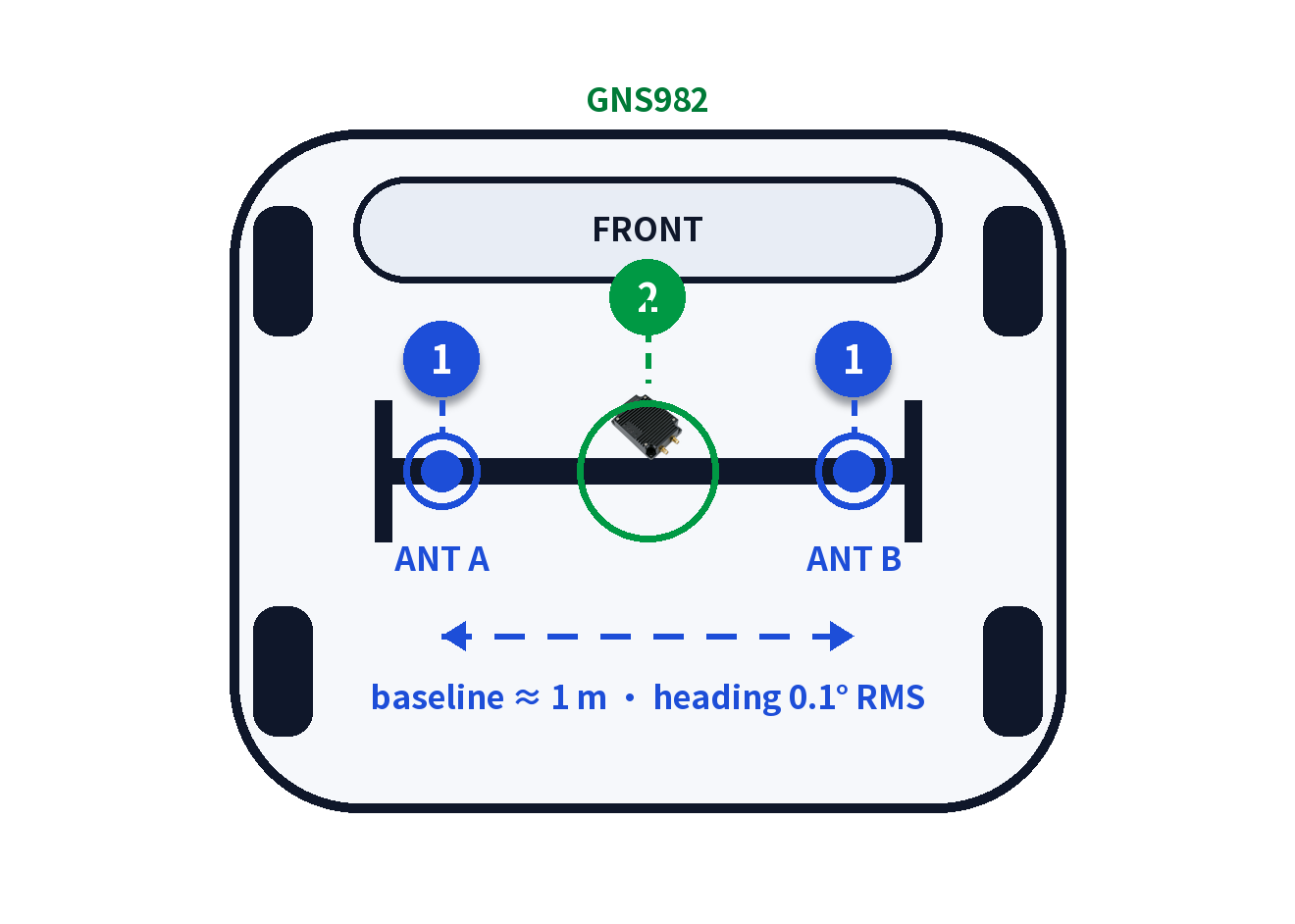
Heading is where single-antenna GNSS fails — a stopped vehicle has no course-over-ground, and magnetometers lie next to steel chassis and drive motors. The GNS982's dual-antenna RTK arrangement measures true heading to 0.1° per metre of baseline, while its internal Kalman filter fuses gyroscope and accelerometer data to hold 0.15° attitude and 0.1 m/s velocity through a full 60 seconds of GNSS lockout.
Typical use case

One unit, three jobs on every mission

  • Localization & mapping pose feed — fused position, velocity and attitude at 5 Hz give the perception stack a georeferenced pose for lidar and camera data, indoors-out.
  • Path-tracking feedforward — true heading from the dual antennas lets the steering controller command curvature instead of chasing course-over-ground noise at low speed.
  • GNSS-outage bridging in depots and yards — during the 60 s lockout window the INS carries pose through docking bays, under cranes and between high stacks — without stopping the mission.
Ruicom GNS982 · roof-rail mounting layout
Recommended product
GNS982 Combined INS

Dual-antenna MEMS combined inertial navigation — RTK centimetre positioning, true baseline heading and full attitude, velocity and position output through an error-compensating Kalman filter that suppresses gyro drift and bridges GNSS outages.

GNSS
GPS + BDS · RTK 0.8 cm + 1 ppm (H)
Dual-antenna heading
0.1° / 1 m baseline (RMS)
Attitude (nav-locked)
Roll / pitch / heading 0.1° (1σ)
Velocity / update
0.03 m/s · 5 Hz nav / 200 Hz INS
Gyro / accelerometer
±300°/s · ±8 g
Attitude @ 60 s outage
0.15° · velocity 0.1 m/s
Interface
2 × RS232 · 2 × GNSS antenna (TTL / CAN opt.)
Supply
9–36 VDC · 250–350 mA @ 12 V
Size / weight
95.2 × 64 × 23.5 mm · ≤227 g
Unmanned Vehicle Application Ruicom · Combined inertial navigation for autonomous operation vehicles